Whitehorse Travel Guide: Your Complete Introduction to the Yukon Capital
Whitehorse is home to three-quarters of the Yukon's population and the starting point for nearly every journey into the territory. Here's how to orient yourself, what to see, and how to use the city as your base for the north.
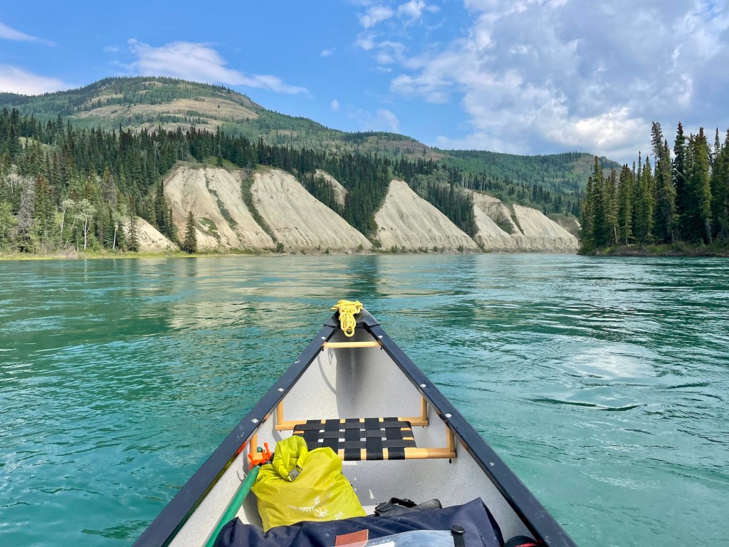
Whitehorse sits in a broad valley on the Yukon River, flanked by forested ridges and the canyon that gives the city its name. The White Horse Rapids — now drowned out behind the hydroelectric dam — were once the most feared obstacle on the gold rush river route north. I’ve talked to old-timers who still remember the roar. Today, Whitehorse is a small, modern city of about 30,000 people that quietly runs the territory’s economy, government, and arts scene.
It’s more urban than most visitors expect. Downtown is compact and walkable, there’s a serious restaurant scene, and the galleries and museums could hold their own in a southern city three times the size.
## Getting There
Erik Nielsen Whitehorse International Airport has scheduled flights from Vancouver, Calgary, Edmonton, and Yellowknife, operated primarily by Air Canada, WestJet, and Air North (Yukon’s Airline). Whitehorse is the air hub for the territory, and Air North connects it to Dawson City, Old Crow, Watson Lake, and other Yukon communities.
By road, Whitehorse sits at the junction of two lifelines. The Alaska Highway runs east to Watson Lake (456 km) and west to Haines Junction (158 km). The Klondike Highway runs north to Dawson City (535 km) and south to Skagway, Alaska (177 km via the South Klondike Highway).
If you’re driving up from the coast, the South Klondike approach from Skagway is one of the most dramatic ways into the Yukon. You climb through White Pass with hanging glaciers above you and tarns and rock below, then drop off the edge into the interior as the spruce trees thicken and the air dries out.
## What to See and Do
If you only have a couple of days in Whitehorse, start with the history and then work your way outward to the river, the canyon, and the hills.
### MacBride Museum of Yukon History
The [MacBride Museum of Yukon History](https://macbridemuseum.com/) on First Avenue is the single best place to get your bearings on the territory. The main building walks you through Yukon history from Indigenous prehistory through the Klondike Gold Rush, the building of the Alaska Highway in the 1940s, and into the modern mining and government era.
Sam McGee’s log cabin — yes, the same Sam McGee immortalized in Robert Service’s poem — sits right on the grounds, which makes the verses hit a bit differently on a cold day. The museum is open year-round; admission is roughly $10 for adults (check their site for current rates and hours).
### SS Klondike National Historic Site
The [SS Klondike National Historic Site](https://parks.canada.ca/lhn-nhs/yt/ssklondike) preserves the largest surviving sternwheeler from the Yukon River’s freight days. She’s drydocked on the riverfront just south of downtown, beautifully restored and open for self-guided and guided tours.
Stand beside her hull and imagine the decks stacked with sacks of flour, fuel drums, and passengers, pushing upriver to Dawson City. The SS Klondike was still running between Whitehorse and Dawson into the 1950s — not ancient history here. Admission is about $4 for adults; the ship is usually open from late May through early September.
### Yukon Beringia Interpretive Centre
The [Yukon Beringia Interpretive Centre](https://www.beringia.com/) sits right off the Alaska Highway beside the airport. Inside, you’re back in the Ice Age, when much of what is now the Yukon was part of Beringia — the unglaciated land bridge that once connected Asia and North America across what’s now the Bering Sea.
The fossil collection is superb, including a near-complete woolly mammoth and other megafauna dug out of permafrost and placer cuts. It’s one of the strongest Ice Age interpretation centres anywhere in the north. Admission is roughly $6 for adults; open May through September, with shorter hours in winter.
### Kwanlin Dün Cultural Centre
The Kwanlin Dün Cultural Centre sits right on the Yukon River, a short walk from downtown. The building itself is a statement — its form echoes the traditional longhouses of the Kwanlin Dün First Nation, whose traditional territory includes what is now Whitehorse.
Inside, you’ll find cultural programming, art exhibitions, and community events. Entry to the main gallery is free, and it’s an easy place to spend an hour between the exhibits and the river views outside.
### Miles Canyon
Miles Canyon, about 8 kilometres south of downtown via Miles Canyon Road, is where the Yukon River squeezes itself between dark basalt walls and speeds up. There’s a suspension bridge over the gorge, and a trail system that runs along both banks for several kilometres.
In 1898 this was among the most dangerous stretches of the stampeders’ river route. The North-West Mounted Police eventually set up a post here, forcing overloaded boats to be inspected and passengers to walk around the worst of the water. These days it’s a favourite local walk — quiet spruce forest, the green river below, and firm, well-used trails. Free; accessible year-round, though footing can be icy in winter and spring.
### Fish Ladder at the Whitehorse Dam
From roughly mid-July through September, Chinook salmon fight their way up a fish ladder around the Whitehorse dam on their spawning migration. You can watch them through underwater viewing windows as they hold in the current and surge past.
On the right day, with big fish moving through, it’s hard to tear yourself away. The facility is free to visit and is operated by Yukon Energy.
### Yukon Wildlife Preserve
The Yukon Wildlife Preserve, on Fish Lake Road about 20 minutes west of downtown, is a series of large, natural enclosures showcasing native Yukon wildlife — caribou, muskox, mountain goats, wood bison, Dall sheep, moose, and more.
The animals are wild-born and semi-wild; this isn’t a petting zoo. You follow a loop road and trails through the property, either driving on a tour or walking under your own steam. It’s one of the most reliable ways to see species that otherwise tend to appear as fleeting shapes at the edge of a highway. The preserve is open year-round; adult admission is around $20. See [yukonwildlife.ca](https://yukonwildlife.ca) for current hours, tours, and seasonal programs.
### Eclipse Nordic Hot Springs
Eclipse Nordic Hot Springs (the old Takhini Hot Springs, if you know the name from decades past) sits 26 kilometres north of town on the Hot Springs Road. It’s a natural mineral hot spring developed into a modern pool complex.
The pools are outdoors in a forested setting, and if you’ve never sat in hot water while your hair freezes at -25°C, this is your chance. The steam drifting up into the cold air on a clear winter night is hard to beat. Adult admission is typically around $15.
### Hiking Near Whitehorse

You don’t have to go far to get onto dirt. Grey Mountain, visible from much of the city, has a network of trails accessed from the end of Lewes Boulevard. The Chadden Lake Loop (about 12 km) gives you broad views over the valley and the patchwork of lakes and forest below.
Closer to the water, the Millennium Trail follows the Yukon River for several kilometres right from downtown — a favourite for evening walks and runs. From Miles Canyon, a well-marked trail runs upriver to Canyon City, about 4 km one way. This was once the site of a tramway that helped bypass the worst of the river during the gold rush; interpretive signs along the way point out the remains and tell the stories.
## Day Trips from Whitehorse
If you’re based in Whitehorse for a few days, there are several easy day trips that give you a sense of the wider territory.
**Carcross (74 km south)** – A 45-minute drive on the South Klondike Highway brings you to Carcross, with its pocket of dunes often called the Carcross Desert, the Carcross Commons Indigenous artisan market, and the option to ride the historic White Pass & Yukon Route railway. A full-day return from Whitehorse is comfortable.
**Skagway, Alaska (177 km south)** – The drive over White Pass to Skagway is one of those routes people talk about years later. Skagway itself is a preserved gold rush port and a U.S. National Historic Landmark District. Allow a full day for the trip, and don’t forget your passport for the border crossings.
**Haines Junction (158 km west)** – Haines Junction is the gateway community for Kluane National Park and Reserve, home to some of the largest non-polar icefields on Earth. You can make it a straightforward highway day trip from Whitehorse, but if you’re a hiker or a photographer, the park deserves more than a quick look.
## Where to Stay
The [Hyatt Place Whitehorse](https://www.hyatt.com/hyatt-place/en-US/yxyzh-hyatt-place-whitehorse) sits centrally downtown, with full amenities and modern rooms within easy walking distance of the river and restaurants. The [Westmark Whitehorse](https://www.westmarkhotels.com/properties/westmark-whitehorse/) is the largest property in town and often booked by tour groups.
If you prefer something smaller, the [Edgewater Hotel](https://www.edgewaterhotelwhitehorse.com/) on Main Street has more atmosphere and puts you a short stroll from both the waterfront and most of the city’s eating and drinking spots.
Several excellent B&Bs operate in the residential neighbourhoods north of downtown — quieter, often more personal, and popular with repeat visitors. For camping, the Robert Service Campground on the Yukon riverbank just south of downtown is the best-located option and fills quickly in summer, especially on weekends.
## Where to Eat
The [Burnt Toast Cafe](https://burnttoastcafe.ca/) is the go-to breakfast spot for a lot of locals; on weekend mornings, expect a line and expect it to be worth the wait. [Antoinette’s](https://www.antoinettesrestaurant.com/) serves West African and Caribbean dishes with surprising depth of flavour for such a small northern city — rich stews, bright spices, and generous portions.
[Dirty Northern Public House](https://www.facebook.com/DirtyNorthernPublicHouse/) turns out elevated comfort food with Yukon ingredients; the burgers and game dishes are reliably solid. [Baked for You](https://www.facebook.com/bakedcafewhitehorse/) is where people linger over coffee, pastries, and sandwiches, watching the flow of Main Street go by.
Whitehorse has a broader restaurant scene than most people imagine on the flight north. You’ll find Vietnamese, Thai, and Japanese options alongside the more overtly Yukon-focused spots.
## Best Time to Visit
June and July are peak season. Whitehorse gets more than 19 hours of daylight around the solstice, temperatures often climb above 25°C, and every attraction and tour is in full swing. By August things ease off slightly, the light softens to gold in the evenings, and the Yukon River salmon run is at its peak.
September is quietly one of the best months. Fall colours creep down the hillsides, the summer crowds thin, and on clear nights the aurora starts to show up again. From October through April, you’re into proper cold, but more and more people are coming specifically for northern lights trips.
In late February, the Yukon Sourdough Rendezvous festival leans into winter with dog mushing, snowshoe events, and the famous flour-packing contest. Around the same time, the Yukon Quest sled dog race either starts or finishes in Whitehorse, depending on the year and route.
## Practical Tips
Whitehorse is the last fully stocked supply point before you head north to Dawson City or west toward Haines Junction and beyond. This is where you buy medications, specialty foods, vehicle parts, and camping gear — once you leave town, selection drops off fast. The Real Canadian Superstore and Canadian Tire are the usual one-stop shops for road trippers.
Cell service is solid within the city and along the Alaska Highway corridor for some distance in each direction. It drops off quickly once you head north on the Klondike Highway past Carmacks or west past Haines Junction. Download offline maps and don’t rely on streaming navigation.
The Yukon government’s travel information line (511) provides road condition reports year-round. It’s essential before you drive the Klondike Highway north in winter or tackle the Dempster Highway in any season.
---
## See Also on TheKlondike.net
- [Kwanlin Dün First Nation: People of the Fast-Running Water](/blog/kwanlin-dun-first-nation) — whose territory Whitehorse was built on
- [The Ta'an Kwäch'än Council: People of the Lake at Laberge](/blog/taan-kwachan-council) — the other First Nation sharing this territory
- [The Alaska Highway: A Complete Guide](/blog/alaska-highway-complete-guide) — the highway that made Whitehorse
- [The Klondike Highway: Skagway to Dawson City](/blog/klondike-highway-skagway-to-dawson) — the road north from Whitehorse
- [Haines Junction Travel Guide](/blog/haines-junction-gateway-kluane) — 158 km west, gateway to Kluane
- [Dawson City Travel Guide](/blog/dawson-city-48-hours) — 535 km north, the Gold Rush capital
- [Yukon's Historic Sites: A Complete Visitor's Guide](/blog/yukon-historic-sites-visitor-guide) — including the SS Klondike and MacBride Museum