Watson Lake Travel Guide: The Sign Post Forest and Gateway to the Yukon
Watson Lake is most visitors' first stop in the Yukon — and home to one of Canada's most unusual landmarks. Here's your complete guide to Watson Lake, what to see nearby, and what to know before you continue north.
Watson Lake sits near the junction of the Alaska Highway and the Robert Campbell Highway, just inside the Yukon border from British Columbia. For most Alaska Highway travellers driving north, it's the first Yukon community — and the Sign Post Forest is often the first thing they stop for. The town of about 800 people exists almost entirely because of the highway, and the surrounding landscape of lakes, rivers, and boreal forest rewards those who slow down from highway pace.
## Getting There
Watson Lake is 441 kilometres west of Fort Nelson, BC on the Alaska Highway — roughly four to five hours of driving through some of the most remote terrain in British Columbia. From Whitehorse, it is 456 kilometres east — about four hours. There is a small airport with Air North service connecting Watson Lake to Whitehorse; check current schedules as frequency varies seasonally.
Note that Watson Lake operates on Pacific Time, while the rest of the Yukon runs on Mountain Standard Time year-round. This can cause confusion when coordinating with Whitehorse.
## The Sign Post Forest
The Sign Post Forest began on March 2, 1942, when Private Carl K. Lindley of Danville, Illinois — a soldier working on the Alaska Highway construction — nailed a sign to a post pointing toward his hometown. The gesture was one of homesickness; the tradition it started has never stopped. Other soldiers followed during the construction period, then veterans, then travellers. Today the forest contains more than 100,000 signs from every province, territory, state, and country imaginable.
The signs are mounted on wooden posts in a grove beside the Alaska Highway, maintained and catalogued by the town. Bringing your own sign and adding it is entirely encouraged — the town even has a procedure for doing so properly. Spend an hour reading them: you'll find hand-painted plywood from small towns in Saskatchewan, precision-engraved metal from Germany, worn plastic signs from New Zealand. The cumulative effect is genuinely moving.
## What to See and Do
The [Northern Lights Centre](https://northernlightscentre.ca/) offers dome-screen presentations on the aurora borealis, covering the science and mythology of the northern lights. Shows run multiple times daily in season; admission approximately $10 adult. It's a worthwhile stop if you're chasing the aurora further into the Yukon and want context before you go — or if you're passing through in summer and won't be there for the aurora season.
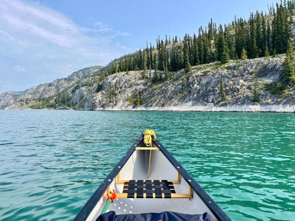
Watson Lake (the lake) sits at the edge of town and offers good lake trout and northern pike fishing, canoeing, and a pleasant waterfront. Boat rentals are sometimes available locally — ask at the visitor information centre.
The Alaska Highway Interpretive Centre, adjacent to the Sign Post Forest, covers the history of the highway's construction in 1942 — one of the largest military engineering projects in North American history. It contextualizes what the Sign Post Forest is actually about.
## Liard Hot Springs Detour
The Liard Highway (Highway 7) heads south from Watson Lake toward Liard Hot Springs Provincial Park in BC — one of the finest natural hot springs in western Canada. The springs are approximately 175 kilometres from Watson Lake (two hours on the highway), and the pools are free to use, maintained by BC Parks. Alpha Pool is the main pool — large, shallow, naturally heated to around 42°C. Beta Pool, a short walk further, is hotter and less visited. Wildlife is common along the Liard River corridor; bison frequent the highway, and the boardwalk to the springs passes through lush vegetation fed by the thermal water. If your schedule allows even one night here, it is exceptional.

## Where to Stay
The [Watson Lake Hotel (Big Horn Hotel)](https://www.bighornhotel.ca/) is the primary full-service accommodation. The Air Force Lodge is a more basic motel option. For camping, the Watson Lake Campground sits on the lake and is quieter than the highway-adjacent options — it's the better choice for tent campers. The Downtown RV Park near the Sign Post Forest is the most convenient for RVers who want to be close to the main attraction.
## Where to Eat
Dining options in Watson Lake are limited. The Big Horn Hotel restaurant is the most reliable option for a sit-down meal. The Gateway Motor Inn serves standard highway fare. Stock up on groceries at the Northern Store before heading either direction — selection is reasonable and prices, while higher than in southern Canada, are better than in smaller communities further up the highway.
## Best Time to Visit
June through August is the primary travel season — all services are open, the lake is accessible, and the long days make Watson Lake feel more alive than it does in shoulder seasons. September and October bring fall colours to the surrounding boreal forest and excellent aurora viewing on clear nights. The Northern Lights Centre is open year-round and winter aurora viewing from Watson Lake can be spectacular.
## Practical Tips
Fuel is available in Watson Lake at several stations — fill up before heading either direction. The next reliable fuel west is Teslin, 175 kilometres away. Heading south on the Liard Highway toward the hot springs, the next fuel is Coal River (80 km south).
The highway between Watson Lake and Fort Nelson (BC) passes through extremely remote terrain. Ensure your vehicle is in good condition, carry a spare tire, and have emergency supplies. Cell service is unavailable for most of this stretch.
The Robert Campbell Highway (Highway 4), which heads north from Watson Lake toward Faro and eventually connects to the Klondike Highway at Carmacks, is a long, remote, partially gravel route through spectacular wilderness. It is passable for most vehicles but requires advance planning and is not recommended without a spare tire and emergency supplies.
## Wildlife and Natural Environment
Watson Lake’s surrounding wilderness offers visitors a chance to experience the pristine natural environment of the Yukon. The region is home to an array of wildlife including moose, bears, wolves, and caribou. Birdwatchers can find a variety of species along the lakes and rivers, such as loons, eagles, and migratory waterfowl. The town's location in the boreal forest provides a lush backdrop of spruce and pine trees, creating opportunities for hiking and nature walks. Trails around the area offer solitude and a chance to connect with the untouched landscape.
The nearby Frances Lake, accessible via a scenic drive on the Robert Campbell Highway, is another gem for those seeking tranquility and nature-based activities. The lake is ideal for fishing, canoeing, and wildlife viewing. A day trip here offers a deeper dive into the Yukon's natural beauty away from the main highway routes.
## Cultural Insights
The cultural fabric of Watson Lake is woven with the history and traditions of the Kaska First Nation, whose ancestral lands encompass the region. Visitors interested in learning more about the Kaska culture can seek out local events and community gatherings that sometimes take place in town. Although there is no formal cultural centre in Watson Lake, engaging with local residents and participating in community activities can provide valuable insights into the traditions and lifestyle of the indigenous people.
The annual “Midnight Sun” golf tournament, though not exclusively a cultural event, brings together residents and visitors alike for a unique golfing experience under the extended daylight of the Yukon summer. Such events highlight the community spirit and resilience of those living in this remote part of Canada.
---
## See Also on TheKlondike.net
- [The Liard First Nation: Kaska People of the Southeast](/blog/liard-first-nation) — the First Nation whose traditional territory surrounds Watson Lake
- [The Alaska Highway: A Complete Guide](/blog/alaska-highway-complete-guide) — the road Watson Lake exists to serve
- [Teslin Travel Guide](/blog/teslin-george-johnston-museum) — 175 km northwest on the Alaska Highway
- [Whitehorse Travel Guide](/blog/whitehorse-essential-guide) — 450 km northwest, the territorial capital