Mayo Travel Guide: The Silver Trail and Keno City
Mayo is the hub of the Yukon's Silver Trail — a region shaped by a century of silver, lead, and zinc mining. From the Binet House interpretive centre to the atmospheric ghost town of Keno City, this is one of the the Yukon's most rewarding and least-visited routes.
Mayo sits on the banks of the Stewart River, reached by turning east off the Klondike Highway at Stewart Crossing and driving 55 kilometres on the Silver Trail (Highway 11). The community of about 400 people is the hub of one of Canada's most significant historic silver-mining regions, and the base for exploring Keno City — one of the Yukon's most atmospheric near-ghost towns. This is an undervisited corner of the territory that rewards those who take the time to leave the main highway.
## Getting There
From Whitehorse, drive north on the Klondike Highway to Stewart Crossing (310 km, about 3 hours), then east on the Silver Trail for 55 kilometres to Mayo — total about 3.5 to 4 hours. The Silver Trail is paved from Stewart Crossing to Mayo and continues as an unpaved gravel road for another 56 kilometres to Keno City. Allow an extra hour for the Keno City section.
From Dawson City, take the Klondike Highway south to Stewart Crossing (190 km, about 2 hours), then east — about 2.5 hours total to Mayo. This makes Mayo a natural stop for those driving between Dawson and Whitehorse who want to leave the main highway.
There is a small airstrip in Mayo with charter service; no scheduled commercial flights.
## Binet House and Mayo Town
The [Binet House](https://www.heritageyukon.ca/our-heritage/heritage-places/binet-house-interpretive-centre/) on Centre Street is a beautifully restored heritage building that serves as the interpretive centre for the Silver Trail region. The exhibits cover the history of silver and lead mining in the Stewart River watershed — one of Canada's richest silver districts, which produced ore from the 1910s through the late twentieth century — as well as the history and culture of the Nacho Nyäk Dun First Nation and the families who built lives here across multiple generations. The staff are knowledgeable and genuinely interested in the stories. Open summer months; free or low admission.
The Mayo Historical Society has identified and marked several historic buildings in town — a walking tour map is available at the Binet House. The town's waterfront on the Stewart River is pleasant for a stroll; the river is large and clear here, flowing out of the Yukon highlands toward its confluence with the Yukon River.
Mayo Lake, 15 kilometres north of town, is excellent for fishing — lake trout, northern pike, and Arctic grayling. The Yukon government campground on the lake sits directly on the shore with mountain views; it's a beautiful spot and far less visited than campgrounds on the main highway.
## Keno City
Keno City, 56 kilometres northeast of Mayo on an unpaved road, is one of the most atmospheric small communities in the Yukon — a near-ghost town with a permanent population of perhaps 20 to 30 people, set against the dramatic silhouette of Keno Hill and surrounded by the remnants of a silver-mining empire.
The [Keno City Mining Museum](https://kenocitymuseum.ca/) holds the story of one of Canada's richest silver-mining districts: the discovery of the Galena Hill silver vein in 1919, the boom years of the 1920s, the long periods of activity and inactivity through the twentieth century, and the complex machinery and human lives involved. The museum occupies a historic building in the centre of town; volunteer staff provide guided interpretation and are a remarkable resource for anyone interested in mining history. The Keno Hill headframe is visible from the main street.
Keno Hill itself, rising above the town, is riddled with old mine adits (horizontal tunnels), equipment, and tailings. A rough road climbs to near the summit. Do not enter old mine workings — they are structurally unstable and often contain dangerous gases. The views from the upper slopes, however, are extraordinary: the Wernecke Mountains to the north, the Silver Range to the south, and the vast boreal plateau stretching in every direction.

Five kilometres north of Keno City, a signpost marks Keno Summit at 1,760 metres — the highest point on the Silver Trail road. From here, the landscape transitions to low tundra: dwarf birch, arctic wildflowers in July, and views that feel genuinely Arctic despite being well south of the Circle.
## Where to Stay
The [Bedrock Motel](https://www.travelyukon.com/en/see-and-do/experience-providers/bedrock-motel-rv-park) in Mayo is the main accommodation option — functional, clean, and the obvious base for exploring the Silver Trail. Keno City has a small hostel in a historic building — basic, atmospheric, and the right choice for those who want to be in the town itself. Mayo Lake Campground, 15 km north of town, is the best camping in the area — lakeside sites, excellent fishing, and a sense of genuine remoteness.
## Where to Eat
The Mayo Hotel's restaurant is the primary dining option in Mayo — straightforward road food with reliable hours. Stock up on groceries at the local store before heading to Keno City — there is no restaurant or grocery store there. Keno City's community social centre occasionally serves food when there are events; ask locally when you arrive.
## Best Time to Visit
Late June through August for full access to the Silver Trail and Keno City, comfortable road conditions, and the Keno City Mining Museum open. The road to Keno can be muddy in spring (May to early June). September brings spectacular fall colours to the sub-alpine above Keno — the combination of silver mine relics and golden larch is one of the finest autumn scenes in the territory.
## Practical Tips
Fill up on fuel in Mayo — there is no fuel in Keno City, and the 56-kilometre gravel road each way means you need a full tank before setting out. The Keno road is dusty in dry conditions; slow down when you see oncoming vehicles and give them room. A high-clearance vehicle is helpful but most passenger cars manage in dry summer conditions if driven carefully.
Cell service is available in Mayo and disappears entirely as you head toward Keno City. Download offline maps. The road to Keno from Mayo is marked as Highway 11 on maps but is a single-lane gravel track for most of its length — an adventure, but entirely worth it.
## Additional Attractions
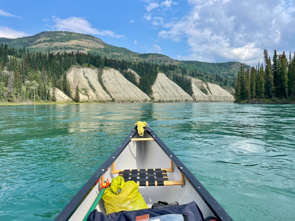
### Stewart River Paddling
For those interested in water adventures, the Stewart River offers a compelling paddling experience. While the river's flow is generally calm, allowing for easy navigation, it provides a stunning perspective of the surrounding wilderness. Canoe rentals are available in Whitehorse or Dawson City, and paddlers should plan for a few days to traverse the river comfortably. The riverbanks are rich with wildlife, including moose and bald eagles, and the peaceful environment enhances the paddling experience.
### Hiking Opportunities
The region surrounding Mayo and Keno City is a hiker's paradise, with trails that cater to various levels of experience. The Wernecke Mountains, visible from Keno Hill, offer more challenging treks with rewarding views. For a less strenuous option, the trails around Mayo Lake provide excellent opportunities for day hikes amidst picturesque landscapes. Proper gear is essential, as weather conditions can change rapidly in the Yukon. Always inform someone of your itinerary when venturing out into remote areas.
## Cultural Insights
### Nacho Nyäk Dun First Nation
The presence of the Nacho Nyäk Dun First Nation is a significant element of the region's cultural landscape. Visitors have the opportunity to learn about the community's rich history and traditions, which are interwoven with the land. The First Nation plays an active role in the stewardship of the area's natural resources, and their cultural practices and knowledge offer a deeper understanding of the Yukon's heritage. Participating in community events, when available, provides a unique insight into the enduring connection between the Indigenous people and the land.
---
## See Also on TheKlondike.net
- [The First Nation of Na-Cho Nyäk Dun: Big River People of the Stewart](/blog/nacho-nyak-dun-first-nation) — the First Nation of the Mayo and Silver Trail region
- [Yukon's Historic Sites: A Complete Visitor's Guide](/blog/yukon-historic-sites-visitor-guide) — including the Binet House and Keno City Mining Museum
- [The Klondike Highway: Skagway to Dawson City](/blog/klondike-highway-skagway-to-dawson) — the main highway to reach Stewart Crossing
- [Dawson City Travel Guide](/blog/dawson-city-48-hours) — 190 km northwest of Stewart Crossing