Driving the Dempster Highway: Dawson City to Inuvik and Tuktoyaktuk
The Dempster is Canada's only public highway to cross the Arctic Circle — 736 kilometres of gravel from near Dawson City to Inuvik, now extended all the way to the Arctic Ocean at Tuktoyaktuk. Here's what to know before you drive it.
The Dempster Highway is the great northern road trip of Canada — the only public highway in the country that crosses the Arctic Circle, and, since 2017, the only road that links the rest of Canada to the shore of the Arctic Ocean. It begins in the Yukon, 40 kilometres east of [Dawson City](/blog/dawson-city-48-hours) on the Klondike Highway, and runs 736 kilometres of gravel north and east — across two mountain ranges and the edge of the Mackenzie River delta — to Inuvik, Northwest Territories. From Inuvik a newer road carries on another 138 kilometres to Tuktoyaktuk, on the Beaufort Sea.
This is not a casual drive. It is remote, unpaved, and weather-dependent, with hundreds of kilometres between services. But for those who make the journey, it is one of the most extraordinary drives on the continent — and the only way, short of flying, to put your feet in the Arctic Ocean from a Canadian road.
## A road built on ice
The highway is named after Corporal William John Duncan Dempster of the North-West Mounted Police. It was decades in the making: construction began in 1959, and the road did not officially open until 1979. The reason it took so long is the same reason it is so remarkable — it is built across continuous permafrost. The Dempster sits on a thick gravel berm laid over the tundra to insulate the frozen ground beneath; without that insulating pad, the permafrost would thaw and the road would sink. You are, quite literally, driving on a gravel bridge over ice.
## The route north
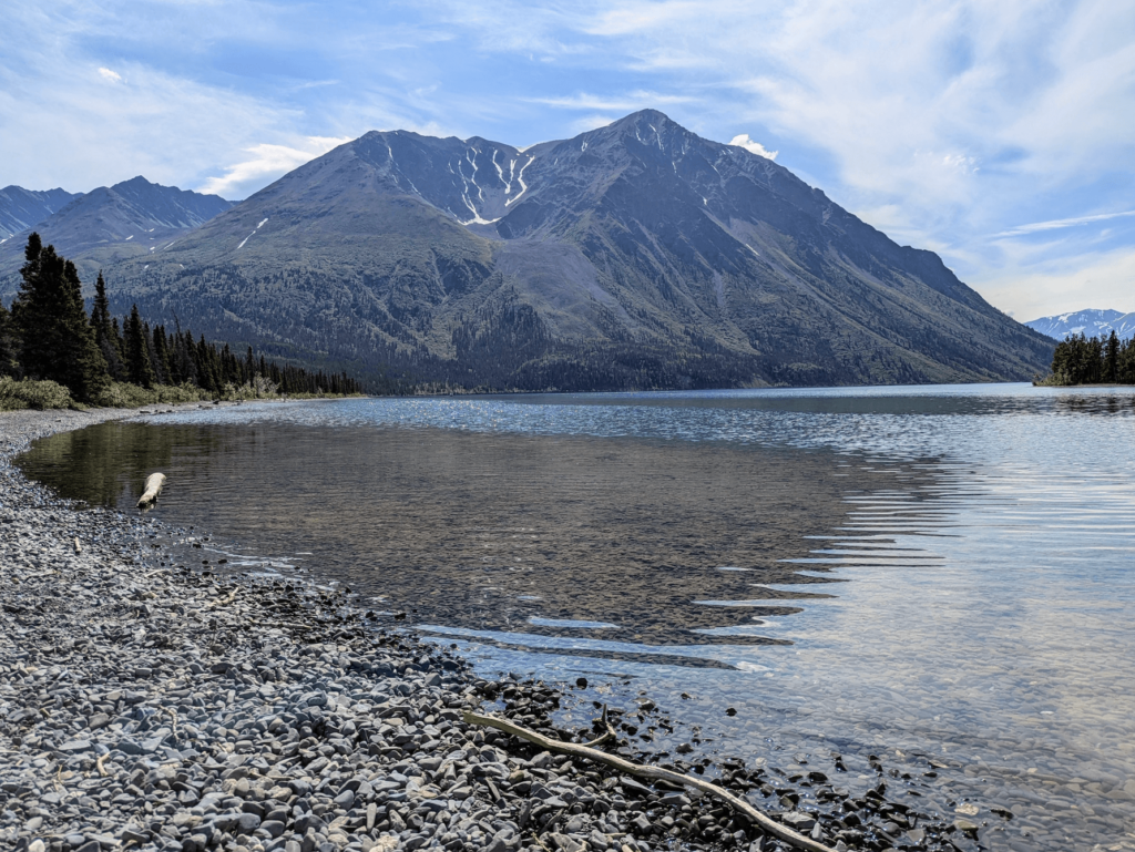
The first stretch out of the Klondike Highway climbs into the Ogilvie Mountains and through [Tombstone Territorial Park](/travel/tombstone-territorial-park), whose jagged granite peaks and tundra valleys are among the finest scenery in the Yukon. The interpretive centre near kilometre 72 is well worth a stop. Beyond Tombstone the highway crosses North Fork Pass — at 1,298 metres the highest point on the road and the continental divide between the Yukon and Mackenzie watersheds.
Roughly midway sits Eagle Plains, a lodge and fuel stop perched on a ridge with long views in every direction. It is one of the only places to refuel on the entire route, so arrive with a plan. A short distance beyond, at kilometre 405, a roadside sign marks the crossing of the Arctic Circle (latitude 66°33′ north) — the line beyond which the sun does not set at the summer solstice. From here the road descends through the Richardson Mountains and crosses into the Northwest Territories.
## The two ferries
The Dempster has no bridges over its two great rivers. In summer, free government ferries carry vehicles across the Peel River near Fort McPherson and the Mackenzie River at Tsiigehtchic. In deep winter, the crossings become ice roads. But during spring break-up and fall freeze-up — roughly some weeks in May and again in October — the rivers are neither solid enough to drive on nor open enough to run a ferry, and the highway is effectively cut. Always check current Yukon and Northwest Territories highway and ferry reports before you set out.
## To the Arctic Ocean: the Inuvik–Tuktoyaktuk Highway
For most of its history the Dempster ended at Inuvik, and Tuktoyaktuk could be reached overland only by an ice road across the frozen delta in winter. That changed on November 15, 2017, when the 138-kilometre Inuvik–Tuktoyaktuk Highway opened — the first all-weather road in Canada to reach the Arctic coast. Its completion connected the country by road, as the saying goes, "from coast to coast to coast." Like the Dempster, it is gravel, and it runs across open tundra that turns to a sea of small lakes in summer.

## Tuktoyaktuk
Tuktoyaktuk — "Tuk" to nearly everyone — is an Inuvialuit hamlet of about 900 people on the Beaufort Sea. It is the only community on the Arctic Ocean that you can drive to in Canada. The name means "it looks like a caribou" in Inuvialuktun, and in 1950 the community reclaimed its traditional name from the colonial "Port Brabant." Many travellers mark the end of the road with the time-honoured ritual of wading into the Arctic Ocean.
The land around Tuk holds the greatest concentration of pingos in the world — ice-cored hills that push up out of the flat tundra, some of them many storeys tall. Several are protected within the Pingo Canadian Landmark, a Parks Canada site, and they are visible from town and from the water.
## Inuvik
Inuvik, the gateway to Canada's Western Arctic, sits on the East Channel of the Mackenzie Delta, about 200 kilometres north of the Arctic Circle. It is the largest community on the route and the place to resupply, refuel, and rest. From here, local operators run boat tours that weave through the channels of the Mackenzie — the second-largest river delta in North America — out toward the Arctic Ocean.
## The Wonders of Tombstone Territorial Park
Tombstone Territorial Park is not just a stopover on the Dempster Highway but a destination in its own right. Covering over 2,100 square kilometers, it offers a striking contrast of rugged peaks and lush valleys. The park is home to a rich tapestry of flora and fauna, with opportunities for hiking and wildlife viewing that are unparalleled in the Yukon. Trails range from short walks to multi-day backcountry excursions, each offering a glimpse into the park's unique ecosystem.
Visitors can expect to see Dall sheep, grizzly bears, and an array of bird species. In the fall, the landscape transforms into a vibrant canvas of reds, oranges, and yellows, making it one of the most picturesque times to visit. The park's interpretive centre offers insight into the natural and cultural history of the region, and guided tours are available for those looking to delve deeper into its secrets.
## Seasonal Considerations
The Dempster Highway is a journey heavily influenced by the seasons. In summer, the midnight sun provides endless daylight, making it a prime time for travel. However, summer also brings mosquitoes, so come prepared. Fall is brief but spectacular, with autumn colors peaking in early September. By late September, snow can begin to fall, and temperatures drop rapidly.
Winter travel demands a different level of preparation. The highway is open year-round, but winter conditions can be harsh. The ice roads that replace ferries in the colder months are a unique experience, but ensure your vehicle is equipped for extreme cold. Spring is unpredictable, with thawing conditions potentially affecting road usability. Always plan for the seasonal challenges that come with a remote northern journey.
## Practical advice
- **Gravel, and lots of it.** Carry two full-size spare tires, a working jack, and a tire-repair kit. Flat tires and cracked windshields are the most common Dempster mishaps.
- **Fuel discipline.** Reliable fuel exists only at Eagle Plains, Fort McPherson, Inuvik, and Tuktoyaktuk. Fill up at every opportunity and never pass a pump on a half tank.
- **Mind the seasons.** The ferries run in summer; ice crossings form in deep winter; spring break-up and fall freeze-up can close the river crossings for weeks. Check highway reports before and during your trip.
- **Allow time.** This is a multi-day drive each way, not a day trip. Build in slack for weather and road conditions.
- **Go self-sufficient.** Cell coverage is minimal between communities. Carry extra food, water, warm layers, and ideally a satellite communicator.
The reward for all this preparation is a drive unlike any other in Canada: tundra to every horizon, the midnight sun overhead, two mountain ranges, two great rivers, and a road that ends only when the land does.
---
## See Also on TheKlondike.net
- [What It's Like to Drive the Dempster Highway](/blog/driving-dempster-highway) — a first-hand account of the road
- [Dawson City Travel Guide](/blog/dawson-city-48-hours) — the launching point for the Dempster
- [The Klondike Highway: From Skagway to Dawson City](/blog/klondike-highway-skagway-to-dawson) — how to reach the start of the Dempster
- [Tombstone Territorial Park](/travel/tombstone-territorial-park) — the spectacular first stretch of the drive